
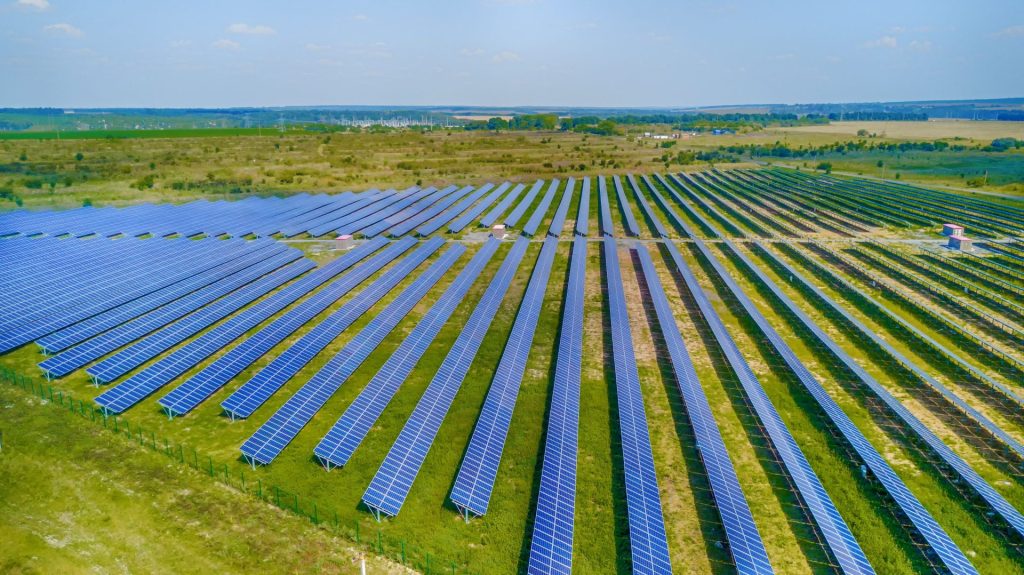
Successful vegetation establishment on a utility-scale solar site begins well before seed reaches the ground. Accurate site information helps vegetation teams understand acreage, boundaries, infrastructure, terrain, and other conditions that influence how a project should be approached.
GPS-validated site mapping gives FDCE the information needed to plan more precisely, deploy resources efficiently, and deliver consistent vegetation establishment across solar projects nationwide.
Why Accurate Site Mapping Matters
Solar sites can cover hundreds or even thousands of acres, often with complex layouts and varying conditions throughout the property. Small inaccuracies in acreage or boundaries can become significant when planning seed quantities, equipment needs, labor, and project schedules.
Accurate mapping helps project teams:
- Confirm treatment and planting areas
- Calculate acreage more precisely
- Identify site boundaries and exclusion zones
- Plan equipment access and movement
- Estimate seed and material requirements
- Improve consistency across large or complex projects
Starting with reliable information reduces uncertainty and gives vegetation establishment crews a clearer plan before fieldwork begins.
Using GPS to Validate Site Conditions
Confirming Project Boundaries
Plans and existing maps provide important information, but field conditions do not always match what appears on paper. GPS technology can help validate boundaries and provide a more accurate understanding of the areas requiring vegetation establishment.
Identifying Infrastructure
Solar arrays include panels, access roads, fencing, drainage features, electrical equipment, and other infrastructure. Mapping these features helps crews plan work around them while maintaining appropriate coverage.
Understanding Site Layout
Every project presents different terrain, access points, and planting challenges. Detailed mapping allows the vegetation plan to account for those differences instead of treating the entire site as though conditions are uniform.
Better Planning Leads to More Efficient Establishment
Once a site’s layout has been accurately documented, that information can guide decisions throughout the establishment process.
Seed quantities can be matched more closely to actual acreage. Equipment and crews can be deployed according to the areas they need to cover. Difficult or inaccessible sections can be identified before they slow down field operations.
This preparation becomes particularly valuable on large solar projects, where even minor inefficiencies can multiply across hundreds of acres.
Supporting Consistent Seed Coverage
One of the primary goals of solar vegetation establishment is achieving consistent coverage across the project. Accurate mapping provides a framework for tracking where work has occurred and identifying areas that may require additional attention.
Reducing Gaps
Careful layout planning helps crews understand exactly where planting is required, reducing the chance that difficult corners or less accessible areas are overlooked.
Limiting Unnecessary Overlap
More precise field information can also help reduce redundant passes, supporting more efficient use of seed, equipment, fuel, and labor.
Improving Follow-Up
Mapping creates a valuable reference for future site evaluations. If vegetation establishment varies across the property, teams can more easily identify specific areas for monitoring, reseeding, or other corrective measures.
Precision Matters Beyond Initial Seeding
The value of detailed site mapping does not end once planting is complete. Accurate site information can support vegetation management throughout the life of the project.
Mapping can help with:
- Documenting establishment progress
- Identifying areas with persistent weed pressure
- Locating erosion or drainage concerns
- Planning mowing and vegetation control activities
- Tracking areas that require reseeding or additional treatment
Over time, this information can contribute to a more targeted vegetation management strategy and help project teams make decisions based on actual site conditions.
Bringing Consistency to Projects Nationwide
Managing vegetation establishment across multiple states requires the ability to adapt to different soils, climates, terrain, and project designs. While conditions may change from one site to another, a precise planning process provides consistency in how each project is evaluated and executed.
GPS-validated mapping helps FDCE develop site-specific strategies while maintaining an organized approach across its nationwide operations. That combination of local understanding and repeatable processes is particularly important for developers and asset owners managing large or geographically diverse solar portfolios.
Building Better Vegetation Plans from the Ground Up
Reliable solar vegetation establishment starts with knowing the site. Accurate mapping and careful layout planning provide the foundation for better material estimates, efficient field operations, consistent coverage, and more informed long-term maintenance.
FDCE combines GPS-validated site mapping with hands-on vegetation establishment experience to develop strategies tailored to the conditions of each solar project. By bringing greater precision to the planning process, FDCE helps developers and project owners establish healthy vegetation efficiently and consistently across solar sites nationwide.